LOCATION
- Mississippi River mile 849.9 AHP
- 85 miles north of Memphis, 185 miles south of St. Louis
- Designated Enterprise Zone, with local property tax abatements and state income tax credits available
PORT FACILITY
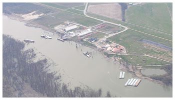
- Slackwater, ice free harbor 4,680 ft. in length with a 300 ft. turning basin at the upper end
- Facilities include a public general cargo dock, and a reliable fleeting operator
TRANSPORTATION
- 3 miles from I-55 and I-155/US Highway 412
- Within 60 miles of US Highway 60 and I-57 and 70 miles from I-40
- 25 miles from Blytheville-Gosnell Airport Authority, with two international airports nearby
- Local air traffic served by the Caruthersville Municipal Airport, 3 miles south of the port
- Access to Burlington Northern-Santa Fe Railroad, with a 5 mile rail spur
MARKET ACCESS
- Transportation links to all surrounding cities, including St. Louis and Memphis
- 43% of the total US population, 41% of the total US retail sales, 42% of the total US manufacturing establishments, and 53% of all US chemical manufacturers are within a two-day drive
INDUSTRIAL DEVELOPMENT
- 30 acres of port-owned building sites available
- Virtually unlimited green fields adjacent to port and rail spur also available for development
UTILITIES
- 3-phase electricity, natural gas, public water and sewer, and broadband capabilities available
111 East 3rd Street
Caruthersville, MO 63830
phone: 573.333.4125 | fax: 573.333.4216
| David Madison | or | John Ferguson |
| pemiscotport@yahoo.com | pemport@yahoo.com |
Visit www.pemiscotport.com
